
October 8, 2026 · Drone Surveyor, LiDAR, Surveying
Drone Surveying in BC and Alberta: Photogrammetry, LiDAR, and Which One Your Project Needs
Two very different sensors fly on the same drone. One sees what a camera sees. The other sees the ground under the trees. Here is how to choose.
Two surveys, one word
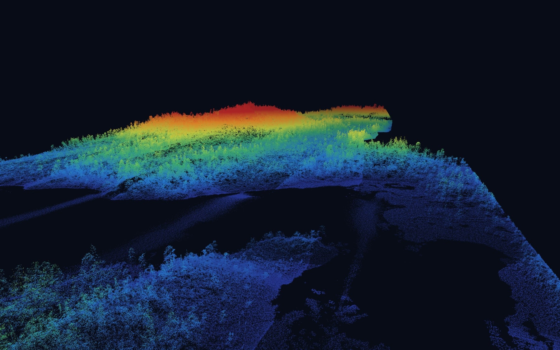
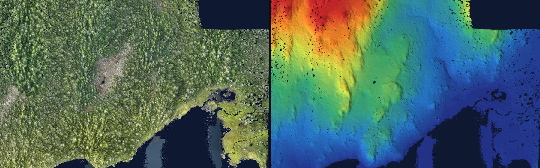
Ask three contractors what a drone survey is and you will get three answers, because there are two of them. A photogrammetry survey flies a camera and builds the site from overlapping photographs. A LiDAR survey flies a laser scanner and measures the site directly, tens of thousands of times a second. They produce different data, they suit different ground, and they are priced differently. PCI Surveys flies both across British Columbia, Alberta and the Yukon, from Edmonton to Prince George, Vancouver to Whitehorse, and the first question on every quote is which one the project actually needs.Every image in this post comes from PCI flights. The point clouds are from a LiDAR survey of a forested lakeshore site in northern BC.
Photogrammetry: the camera survey
The drone flies a grid at a set height and takes hundreds or thousands of overlapping photos, each tagged with a precise position. Software matches the same features between photos and triangulates them into a 3D model of the surface, then drapes the photos back over it. Out of that come an orthophoto (a true-to-scale aerial image), a surface model, contours and volumes.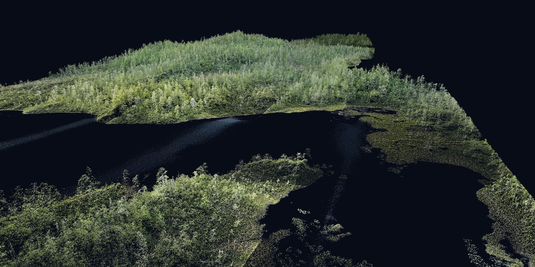
Photogrammetry is the right tool when the ground is visible from the air. Gravel pits and stockpiles, construction sites, well pads and leases, subdivisions under development, cleared right-of-way: the camera captures all of it in sharp, colour detail at a few centimetres per pixel, and the volumes and surfaces that come out of it are accurate enough for monthly quantities and progress reporting. It is also the more economical flight, which matters when a site is flown every month.
Where it fails is anywhere the camera cannot see the ground. Trees, brush, tall crops: photogrammetry models the top of whatever it is looking at, and in a BC or Alberta forest that is not the ground.
LiDAR: the laser survey
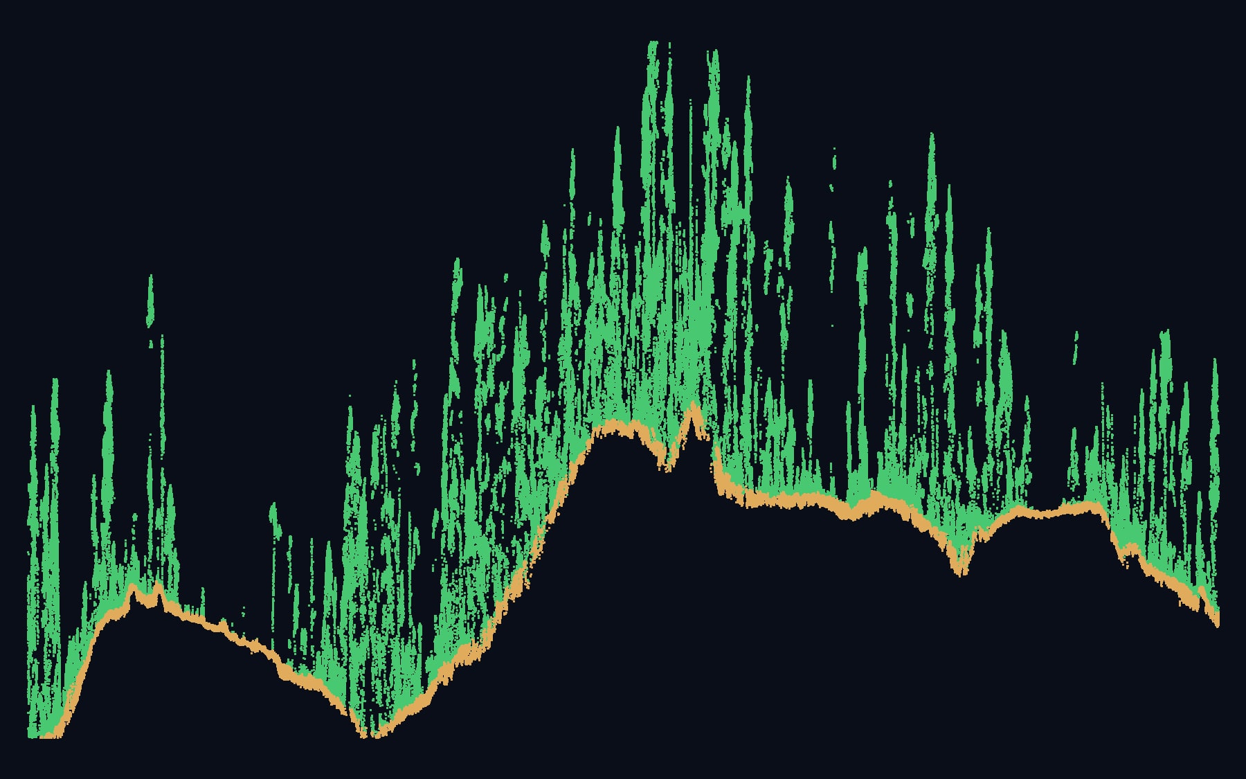
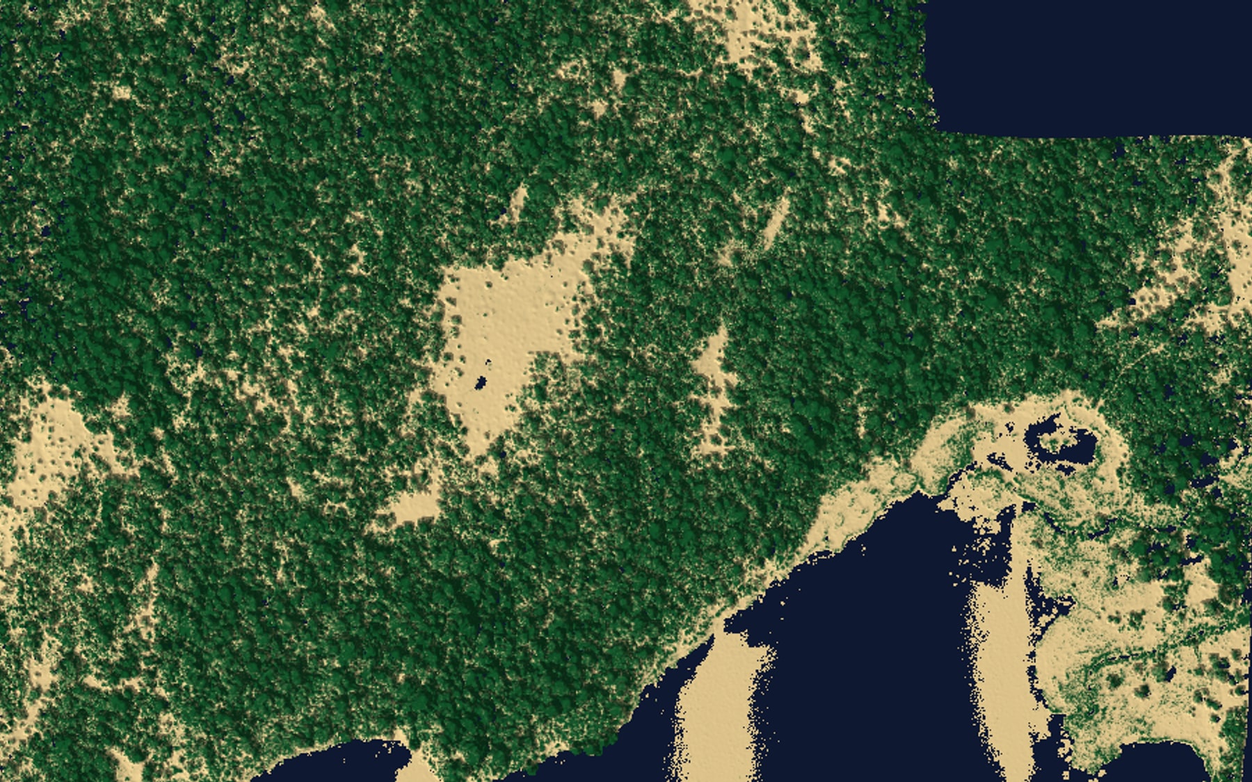
A LiDAR drone fires laser pulses downward and times each return. Through a forest canopy most pulses hit leaves and branches, but a fraction find gaps and return from the actual ground, and the scanner records every return separately. After processing, the ground returns are classified and separated, and the result is a bare-earth terrain model of a site that no camera could ever see.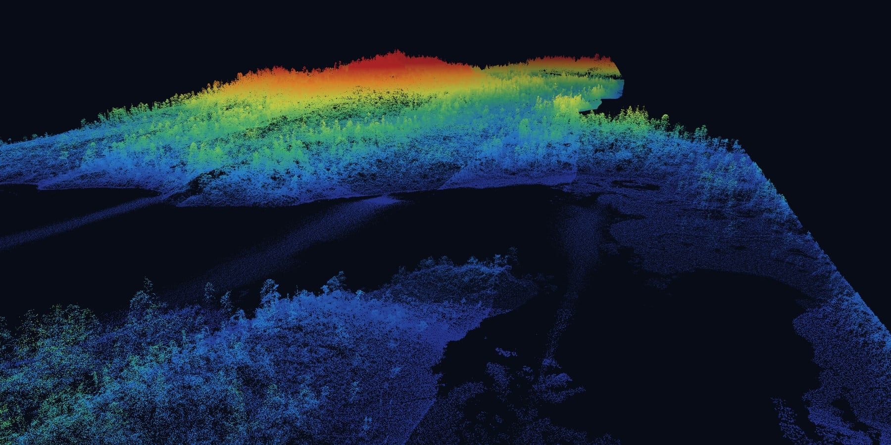
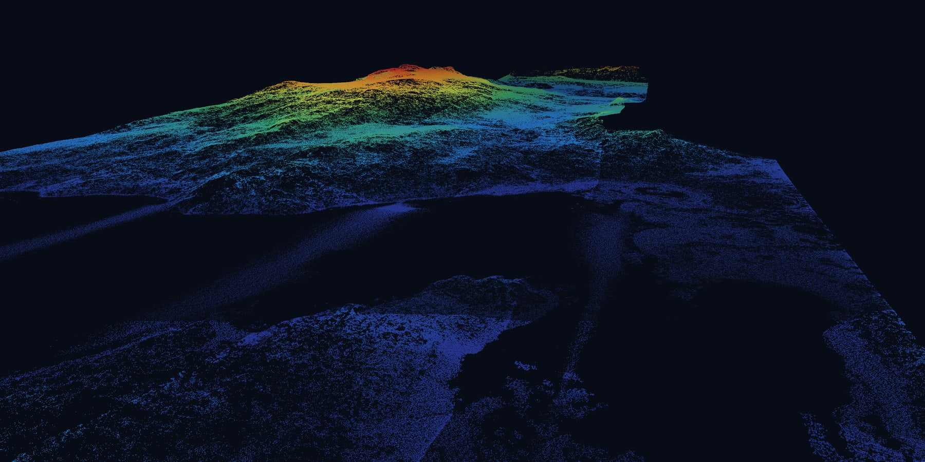
That pair is the whole argument for LiDAR. Both images are the same flight from the same camera position. The first is what the drone measured; the second is what the design engineer needs.
Which one your project needs
Fly photogrammetry when the ground is open. Stockpile and pit volumes, earthworks progress, construction sites, gravel and aggregate operations, well pads, laydowns, graded subdivisions, mine benches. You get colour detail and accurate surfaces at the lowest cost per flight, and repeat flights are easy to compare.
Fly LiDAR when there is vegetation between the drone and the ground. Forested development land, road and pipeline corridors through timber, drainage and flood studies, creek and wetland mapping, cut-block and reclamation terrain, exploration ground, anything where the design depends on the shape of the earth rather than the shape of the canopy.
Fly both when a site has both. This is common on larger projects: a cleared pad inside a treed parcel, a quarry with forested expansion ground, a corridor that crosses open fields and timber. The LiDAR provides the terrain and the camera provides the colour orthophoto, and the two are delivered in the same coordinate system so they overlay exactly.
If you are not sure, send us the site. Looking at the ground is how PCI scopes every drone survey, and the answer is usually obvious within a minute.
What makes either one survey-grade
A drone with a good sensor produces a pretty model. Ground control is what turns it into a survey. On every PCI flight, photogrammetry or LiDAR, the aircraft positions itself with RTK or PPK corrections, ground control points are measured with survey-grade GNSS, and the finished surface is checked against independent points we did not use to build it. The accuracy that goes in the report is measured on that project, not quoted from a brochure.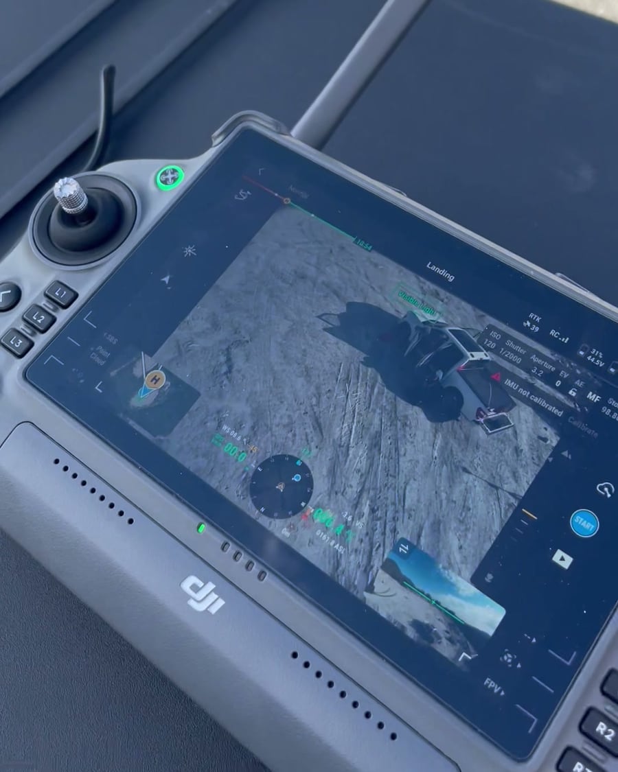
Flights are conducted by certified pilots under Transport Canada regulations, with the airspace permissions each site requires. Remote sites are planned in from the start: crew access, launch points, weather windows and battery logistics are part of the scope, whether the site is an hour from Edmonton or a helicopter ride from Whitehorse.
What you receive
Photogrammetry delivers an orthophoto, a surface model, contours and volume reports. LiDAR delivers a classified point cloud, a bare-earth terrain model, contours, and the analysis built on them: slope, drainage, canopy height, cut and fill against design. Both arrive as GeoTIFF, DWG or DXF, LandXML and Civil 3D surfaces, with a control and accuracy report. For the full list with real examples of each product, see what a drone LiDAR survey actually delivers.Want to see the data itself? Fly a real PCI point cloud in the LiDAR demo, or pull real measurements off a 2 cm orthophoto in the orthophoto demo. Both run in your browser.
Where PCI flies
Drone survey crews are based in Prince George, Edmonton, Vancouver and Whitehorse, covering northern BC, the Lower Mainland, Alberta and the Yukon. Service pages: drone mapping and photogrammetry, drone LiDAR and volumes and earthworks. For the field side of a northern LiDAR job, read drone LiDAR surveying in the Yukon.
PCI Surveys is First Nations-owned, and drone survey work across BC, Alberta and the Yukon routinely sits inside projects with Indigenous participation commitments. On those projects PCI delivers a defined technical scope, flown and controlled properly. More on our First Nations partnerships page.
Get a price for a drone survey
Outline the site on the map, tell us what you need out of it and when, and you will usually see a price as soon as you submit. If you are unsure whether it is a camera job or a LiDAR job, say so: that is the first thing we work out.Request a quote or call the office nearest your project. Crews are out seven days a week, 6 a.m. to 7 p.m.


