
August 22, 2026 · Line Utility Locating, Construction Surveys, Surveying
Pipeline Surveying Across Northern BC: From the Montney to the Coast
The gas comes out of the ground in the northeast and ships from the northwest. Everything in between is survey work. Here is what pipeline surveying and locating look like across the full width of northern British Columbia.
One corridor, eight hundred kilometres wide
Northern BC's gas is produced in the Montney, around Fort St. John, Dawson Creek and Fort Nelson. It leaves the province through terminals at Kitimat and Prince Rupert. Between the two is the Rocky Mountains, the Interior Plateau, the Coast Mountains, and hundreds of kilometres of pipeline that has to be laid out before it is trenched, checked while it goes in, and recorded after it is buried.PCI Surveys works that whole corridor. From the gathering systems and well pads of the northeast, through the mainline crossings of the Rockies, to the compressor sites and terminal tie-ins on the coast, the survey and locating needs change with the ground — but they never go away.
The northeast: gathering systems and well sites
In the Montney, pipeline work is dense and constant. Gathering lines connect pads to processing, water lines feed completions, and the network keeps growing. The survey demand here is volume: lease and pad layout, access road centrelines, pipeline alignments, crossings, and as-builts, week after week.The locating demand is just as steady. A new line almost always crosses an existing one. Before any trench opens, the buried lines in the right-of-way — gathering, water, power to the pad, fibre to the SCADA — have to be found and marked. PCI uses electromagnetic locating to trace conductive lines, and ground-penetrating radar where the target is plastic, the records are thin, or the ground has been worked before.
Around Fort St. John and Dawson Creek, the ground has been worked before more often than not.
The mainline: crossings, grades and control
Once a line leaves the field and heads west, the work changes from dense to remote. A mainline runs through muskeg, river valleys, mountain passes and timber, and the survey has to hold its accuracy across all of it.Control. Long-baseline GNSS control tied to published monuments, densified along the route so every spread has something to work from. On a line that crosses several hundred kilometres, control is the backbone that keeps the whole project in one coordinate system.
Construction layout. Pipe centreline, offsets, bend locations, crossing points and ditch line, staked from the engineered alignment ahead of the grading and ditching crews, and re-staked where the ground moves. Right-of-way boundaries and legal limits are set by a land surveyor; PCI lays out the construction within them.
Crossings. Road, rail, river and foreign-line crossings each need their own survey — profile, cover depth, the location of what is being crossed, and the geometry for the bore or the open cut. Horizontal directional drill crossings are surveyed entry to exit.
Grade and ditch. Profile, bend locations, ditch depth and cover are surveyed so the pipe goes in where the engineering says it should, with the cover the regulator expects.
The coast: terminal tie-ins and legacy ground
At the Kitimat and Prince Rupert end, the mainline meets industrial sites that were already busy. Tie-ins happen inside operating facilities, beside existing process piping, on ground that has been built, rebuilt and cut up over decades.Here facility locating is the job. Every line on the site — power, process, water, fire, communications, cathodic protection — gets traced and marked before the tie-in excavation opens. Sewer camera and sonde locating handles the gravity systems with no conductor to follow. The results are picked up by survey and delivered as a drawing, because on a terminal the marks on the ground are not enough.
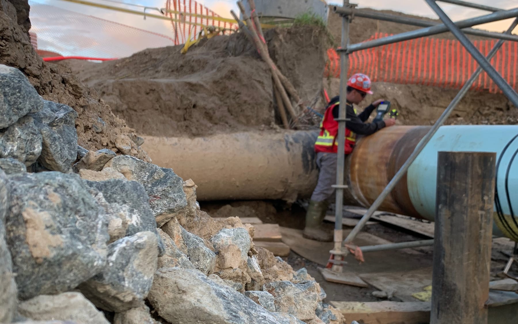
The photograph at the top of this post is a tie-in point: a surveyor with a controller on a large-diameter line at the bottom of a trench, inside a scaffold, between a rock stockpile and a fence. That is what the work looks like. It is rarely tidy.
As-builts: the survey that outlives the project
Every metre of pipe that goes in the ground is surveyed before backfill — pipe centreline, depth of cover, bends, valves, crossings, and the location of every foreign line encountered. That as-built is what the operator runs the line from for the next forty years. It is what the next contractor digs beside. It is the record the regulator asks for.An as-built surveyed properly is a permanent asset. One surveyed badly is a permanent liability. PCI treats the as-built as the final deliverable of the job, not an afterthought once the pipe is covered.
Working the whole corridor
Pipeline work in northern BC means distance. Crews mobilize to camps, to sites off the paved network, and to rights-of-way reached by forest service road, barge or helicopter. PCI plans the mobilization, the equipment and the communications as part of the scope, and crews are out seven days a week because the pipeline schedule does not stop on Saturday.PCI Surveys is First Nations-owned. Pipeline projects across the north cross the territories of many Nations, and most carry Indigenous participation commitments. On those projects PCI delivers a defined technical scope, not a name on a proposal. More on our First Nations partnerships page.
Pipeline survey and locating services
GNSS control · construction layout and centreline staking · crossing surveys · HDD entry and exit surveys · grade, ditch and cover surveys · pipeline as-builts · private and foreign-line locating · electromagnetic locating · ground-penetrating radar · sewer camera and sonde locating · facility locating at terminal and plant sites · drone mapping and LiDAR of corridors.
Related: construction surveying in Terrace, Prince Rupert and Kitimat, private line locating, GPR scanning, drone LiDAR in northern BC, and the coverage map.
Get a price for pipeline survey or locating work
Tell us the location, the scope and the timing. For locating work, outline the route or the area on the map; for survey work, attach the alignment sheets or drawings. In most cases you will see a price as soon as you submit.Request a quote or call the office nearest your project. Crews are out seven days a week, 6 a.m. to 7 p.m.


