
Commercial Construction Surveyor
When a commercial build needs to stay on line, on grade, and on schedule, accurate survey support matters from the start. A commercial construction surveyor helps keep a project moving by providing the layout, control, and [...]

Revealing the Unseen: PCI Surveys’ Ground Penetrating Radar Services
When it comes to construction, infrastructure, or environmental projects, what’s hidden below the surface can pose significant risks or opportunities. Unidentified utilities, voids, or geological features can lead to costly delays or safety issues if [...]
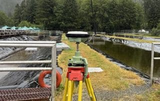
Locates for Drilling and Excavation in BC, Alberta and Yukon
Locates for Drilling and Excavation in BC, Alberta and Yukon Drilling and excavation work demands more than just equipment. It requires knowing what’s beneath the surface. PCI Surveys provides private utility locating services across British [...]
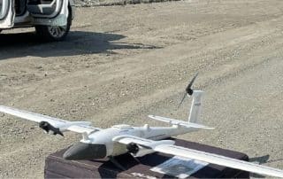
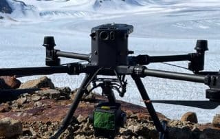
Drone and Aerial LiDAR Surveys in Prince George, Terrace, Smithers and Prince Rupert
Accurate and efficient surveying is essential for industries across Northern British Columbia. Our Drone and LiDAR aerial surveys provide high-resolution mapping and data collection services in Prince George, Terrace, Smithers, and Prince Rupert. Whether for [...]
LiDAR Surveyor Prince George
Looking for high-precision LiDAR surveying in Prince George? PCI Surveys provides advanced aerial and ground-based LiDAR services to support construction, mining, and environmental projects across Northern BC. Using industry-leading technology, we deliver detailed topographic data, [...]
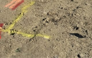
Private Locating for Phase 2 PSI Environmental Drilling
Private Locating for Phase 2 PSI Environmental Drilling Environmental drilling projects, such as Phase 2 PSI (Preliminary Site Investigation), require precise planning and coordination to ensure safety and compliance. Before any drilling begins, it's crucial [...]