

Geomatics Prince George
Construction Surveyors, Engineering Surveys, Mining Surveys, Drone and LiDAR.
PCI Surveys provides all types of Geomatics Surveying in Prince George.
PCI Surveys: Geomatics Services Prince George, BC
At PCI Surveys, we pride ourselves on delivering top-tier geomatics services from our Prince George, BC office. Specializing in construction, mining, and environmental sectors, our expert team leverages advanced technology to provide precise and reliable surveying solutions. Our services are designed to cater to the diverse needs of our clients, ensuring accurate data and efficient project execution.
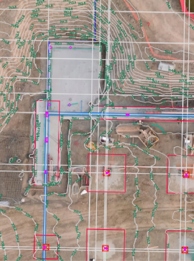
Advanced Topographical Surveys
Topographical surveys are essential for planning and executing any construction or development project. At PCI Surveys, our skilled professionals utilize the latest equipment and techniques to create detailed topographic maps. These maps highlight the natural and man-made features of a site, providing crucial information for architects, engineers, and construction teams. Our topographical surveys help in identifying potential challenges and planning for efficient resource allocation, ensuring projects are completed on time and within budget.
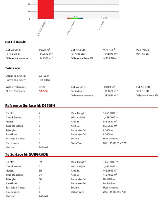
Accurate Quantity Tracking
In the mining and construction industries, precise quantity tracking is vital for effective project management. Our Prince George team excels in monitoring and documenting the volume of materials moved or used on-site. Using cutting-edge technology, we provide accurate measurements that assist in cost estimation, resource management, and compliance with regulatory standards. Our detailed reports ensure stakeholders have the necessary information to make informed decisions and maintain project efficiency.
Construction Progress Monitoring
Keeping track of construction progress is crucial for meeting deadlines and ensuring project quality. PCI Surveys offers comprehensive construction progress monitoring services, utilizing advanced surveying techniques to provide real-time updates on project status. Our team in Prince George uses drones and other high-tech equipment to capture detailed images and data, allowing project managers to assess progress accurately, identify potential issues early, and implement corrective measures promptly.
Precise Terrain Modeling
Terrain modeling is essential for understanding the physical landscape of a project site. Our experts create highly accurate digital terrain models (DTMs) that represent the site’s surface. These models are invaluable for planning construction activities, analyzing drainage patterns, and assessing environmental impacts. At PCI Surveys, we employ state-of-the-art software and surveying equipment to produce detailed and reliable DTMs, ensuring our clients have a clear understanding of the project site.
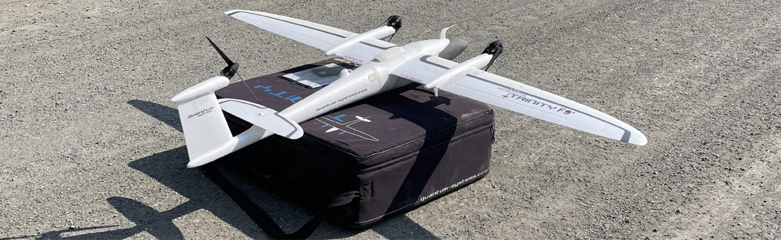
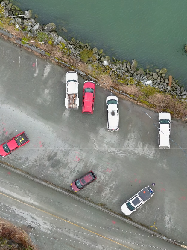
Advanced Photogrammetry Surveys
Photogrammetry is a powerful tool for capturing precise spatial data and creating detailed 3D models. Our Prince George office specializes in photogrammetry surveys, using drones equipped with high-resolution cameras to capture aerial images of the project site. These images are processed using advanced software to create accurate 3D models and maps. Photogrammetry surveys are ideal for large-scale projects, providing comprehensive data that supports effective planning and decision-making.
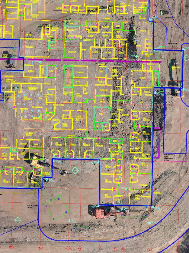
Construction Layout Surveying Services
Construction layout surveying is essential for translating project designs into physical markers on the ground. Our Prince George team at PCI Surveys excels in providing precise construction layout services. We work closely with construction crews to ensure all structural elements are positioned correctly according to the design plans. This includes marking the locations of foundations, walls, utilities, and other critical components. By using advanced equipment and technology, we guarantee high accuracy in our layout services, which helps prevent costly errors and delays in construction projects.
LiDAR Geomatics Services
LiDAR (Light Detection and Ranging) technology allows us to capture highly detailed and accurate topographical data. Our Prince George team utilizes LiDAR to conduct comprehensive surveys that provide precise elevation data and 3D representations of the terrain. This technology is particularly useful for large-scale projects, forestry management, and environmental monitoring. At PCI Surveys, we ensure our LiDAR services deliver the detailed insights needed for effective planning and decision-making.

Commitment to Excellence
At PCI Surveys, we are committed to delivering the highest quality geomatics services to our clients in Prince George and beyond. Our team of experienced professionals uses the latest technology and techniques to ensure accurate, reliable, and timely results. We understand the importance of precision in surveying and strive to exceed our clients’ expectations in every project we undertake.
For more information about our geomatics services in Prince George, BC, or to discuss your specific project needs, please contact PCI Surveys today. Our team is ready to assist you with expert advice and tailored solutions to meet your surveying requirements.