

LiDAR Surveyor in Prince George – Point Cloud Mapping
Accurate, Efficient Terrain Data for Construction, Mining, and Environment
Looking for high-precision LiDAR surveying in Prince George? PCI Surveys provides advanced aerial and ground-based LiDAR services to support construction, mining, and environmental projects across Northern BC. Using industry-leading technology, we deliver detailed topographic data, terrain models, and volume calculations with unmatched accuracy.
As a proud member of the Prince George Chamber of Commerce, we are committed to providing reliable and professional surveying solutions for businesses and industries throughout the region.
Why Choose LiDAR for Surveying?
LiDAR (Light Detection and Ranging) is a cutting-edge remote sensing technology that captures highly accurate 3D data of the Earth’s surface. It offers significant advantages over traditional surveying methods, including:
- High Accuracy: Provides precise elevation data for engineering, construction, and planning.
- Efficient Large-Area Coverage: Surveys vast areas quickly, making it ideal for forestry, mining, and infrastructure projects.
- Penetrates Vegetation: Captures ground surface data even in heavily forested or rugged terrain.
- Safe and Non-Intrusive: Eliminates the need for physical site visits in hazardous or difficult-to-access areas.
Whether you’re working on a construction site, managing a mining operation, or conducting an environmental study, LiDAR offers the most efficient and precise solution for mapping and analysis.
LiDAR Surveying Services in Prince George and Surrounding Areas
PCI Surveys provides professional LiDAR data collection and analysis across Prince George and the surrounding communities, including:
- Prince George
- Vanderhoof
- Fort St. James
- Quesnel
- McBride
- Bear Lake
- Mackenzie
- Fraser Lake
- Valemount
Our team specializes in Northern BC’s unique terrain, providing accurate LiDAR mapping for infrastructure development, resource management, and environmental monitoring.
Applications of LiDAR Surveying
LiDAR is an essential tool for industries that require high-precision mapping and data analysis. Our LiDAR surveying services support a wide range of applications, including:
Construction and Infrastructure Planning
LiDAR provides detailed elevation models that help engineers and developers plan roads, bridges, and building sites with accuracy. Our services include:
- Topographic mapping for pre-construction planning
- Digital Terrain Models (DTMs) for site development
- Monitoring construction progress and earthwork volumes
Mining and Natural Resource Management
Mining companies in Prince George rely on LiDAR for precise volume calculations, slope stability assessments, and resource exploration. We offer:
- Stockpile volume measurements
- Tailings dam monitoring and environmental compliance
- Surface mapping for open-pit mining operations
Forestry and Environmental Studies
LiDAR is highly effective for forestry management, watershed analysis, and environmental assessments. We provide:
- Tree canopy and vegetation density analysis
- Floodplain mapping for water resource management
- Wildlife habitat monitoring and land classification
Oil & Gas and Utility Corridor Mapping
Pipeline and utility companies use LiDAR to map infrastructure corridors and detect terrain changes. Our services include:
- Pipeline route planning and right-of-way mapping
- Vegetation encroachment detection
- Asset management and risk assessment
How We Collect and Process LiDAR Data
PCI Surveys utilizes advanced LiDAR technology to deliver accurate and high-resolution mapping solutions. Our workflow includes:
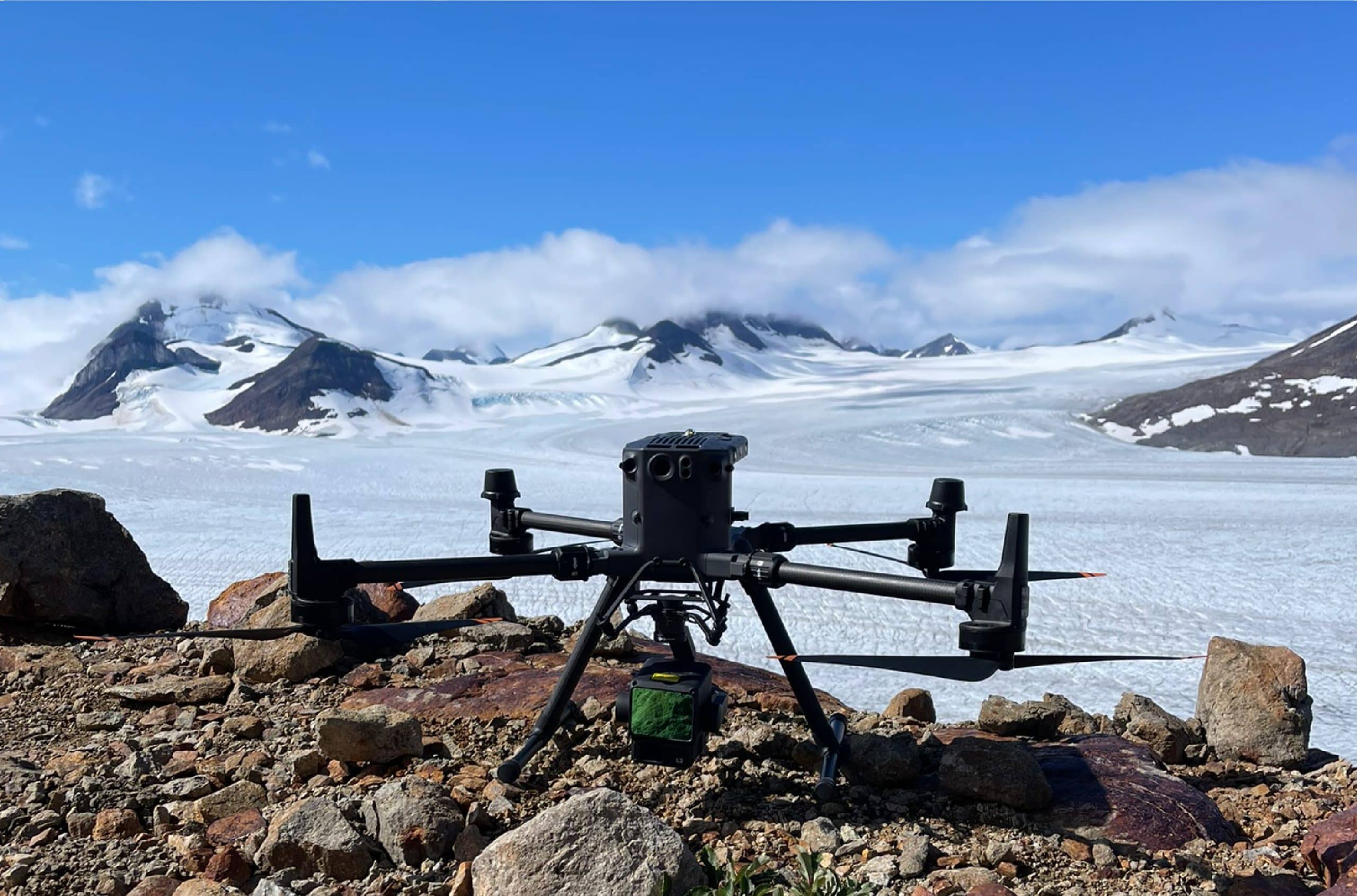
Aerial LiDAR Surveys
We use drone-mounted LiDAR systems to collect detailed topographic data across large areas efficiently. This method is ideal for construction sites, forestry projects, and mining operations.
Ground-Based LiDAR Scanning
For high-precision mapping in confined spaces, we deploy terrestrial LiDAR scanners to capture structural details with millimeter accuracy. This approach is commonly used for infrastructure assessments and industrial facilities.
Data Processing and 3D Modeling
Once collected, our LiDAR data undergoes advanced processing to create:
- Digital Elevation Models (DEMs)
- Contour maps and surface models
- 3D point clouds and volumetric calculations
These outputs provide critical insights for engineers, surveyors, and environmental planners.
Learn More About Our LiDAR Surveying Services
For more details on our LiDAR capabilities, visit our LiDAR surveying page.
Contact Us for LiDAR Surveying in Prince George
Planning a construction, mining, or environmental project in Northern BC? Our professional LiDAR surveyors are ready to provide high-precision mapping for your needs.
PCI SURVEYS – For LiDAR surving in the Prince George area
1299 3rd Avenue, Prince George, BC, V2L 3E6
Telephone: (778) 764-1626
Email: bc@pcisurveys.ca
Accurate. Reliable. Efficient. Get the data you need with PCI Surveys.