
Drone Surveying Unleashed
Western Canada’s Precision Line Solutions
Surveying isn’t just a step—it’s the backbone of construction precision, engineering innovation, mining efficiency, and environmental stewardship. Across Western Canada, from Vancouver’s urban pulse to Whitehorse’s rugged stillness, advanced tools like drones and LiDAR are reshaping how we tackle tough projects. Line locating, especially for private utilities, ties it all together, ensuring every move is safe and spot-on. Here’s how these technologies—rooted in real demand—are powering construction, engineering, mining, and environmental work in Vancouver, Edmonton, Prince George, and Whitehorse.
Why Advanced Surveying Stands Out
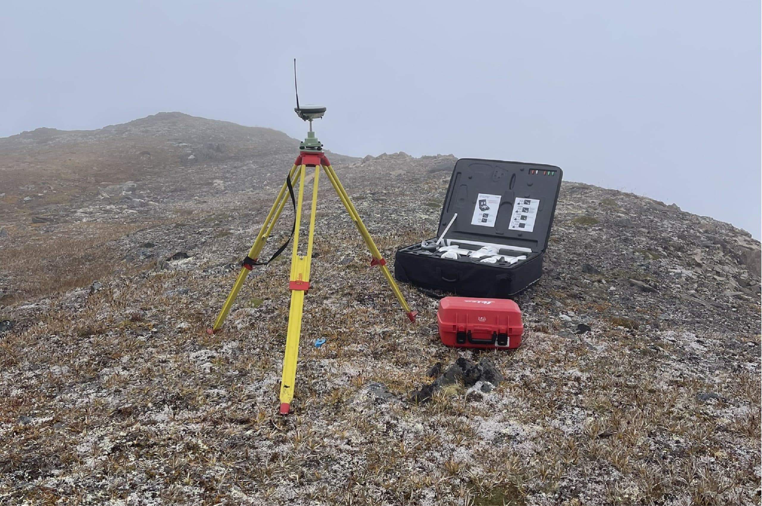
Imagine mapping a 50-hectare mine site or a bustling city block in hours instead of days. Drones make it real, soaring above with high-res cameras to capture every angle fast. LiDAR kicks it up a notch, firing laser pulses to build 3D models through dense forests, snow, or urban clutter. Then there’s line locating—pinpointing underground utilities before the first shovel hits. Private line locating digs into customer-owned lines—like a factory’s water main or a condo’s power feed—where public maps leave off. Whether it’s construction surveying for a new tower, engineering a pipeline, mining a pit, or monitoring wetlands, this combo delivers data that’s quick, reliable, and razor-sharp.
Surveying in Action Across Western Canada
From cityscapes to wilderness, every region has its own beat. Advanced surveying, paired with private line locating, adapts to each one. Here’s how it’s playing out in Vancouver, Edmonton, Prince George, and Whitehorse—where real-world needs meet cutting-edge tech.
Vancouver: Construction and Engineering in a Metro Hub
Vancouver’s skyline screams construction and engineering—think high-rises, transit expansions, or bridges spanning the Fraser. Drone surveying cuts through traffic chaos, mapping a site in a morning when traditional crews might take a week. LiDAR models tight spaces in 3D, dodging cranes to nail every detail. Line locating traces utilities under downtown asphalt—public grids and private lines alike. Take a developer prepping a condo tower: private line locating finds that hidden sewer hookup, dodging a costly misstep. Vancouver surveyors lean on these tools to keep the city’s growth on track, no hiccups allowed.
Edmonton: Balancing Construction and Environmental Duty
Edmonton’s a dual-threat—construction booming alongside environmental care. Drones tackle construction surveying for sprawling subdivisions or industrial yards, outpacing manual pacing with layouts in hours. Engineering surveying shines too—plotting a pipeline across Alberta’s prairies, say, with LiDAR mapping frost-heaved ground or urban edges. Environmental surveys keep watch, tracking wetland health or reclamation as projects grow. Line locating flags buried utilities—like a gas line under a new factory—while private line locating digs deeper, spotting a site’s private water feed that public records miss. Edmonton surveyors use this tech to fuel progress without skipping a safety beat.
Prince George: Mining and Construction in the Wild North
Prince George is Northern BC’s gritty core—mining runs deep, and construction keeps it rolling. Drone surveying maps a 50-hectare mine site in a day, spotting ridges or runoff zones that old methods might overlook. LiDAR pierces thick pine cover for 3D ground models—vital for a new pit or haul road. Environmental surveying tracks the footprint, watching erosion or habitat shifts near a drill site. Line locating charts utilities across remote stretches—power for a mill or water for a camp—while private line locating pinpoints a mine’s private power feed. Prince George surveyors harness these tools to tame rugged country, blending resource wins with smart planning.
Whitehorse: Conquering Remote Construction and Environmental Challenges
Whitehorse is raw—big skies, tough land, and projects that demand grit. Construction surveying for a new highway or building leans on drones to cover Yukon scrub fast—miles in hours. Engineering surveying steps up for big jobs—imagine a dam across a river—where LiDAR’s 3D maps reveal every slope or sinkhole. Environmental surveys are critical here, tracking permafrost melt or caribou trails with precision as development creeps in. Line locating finds utilities in far-off spots—a telecom line snaking through taiga—while private line locating nails down a cabin’s private water line. Whitehorse surveyors wield this tech to bridge the wild with progress.
Line Locating: The Unsung Hero—Private and Public
You can’t dig blind—line locating maps what’s below, from public grids to private lines. Drones and LiDAR spot surface hints, but it’s the underground story that matters. Private line locating is clutch—think a Vancouver condo’s sewer, an Edmonton factory’s gas line, a Prince George mine’s power feed, or a Whitehorse cabin’s water hookup. Where public utility maps stop, this service picks up, using advanced gear to trace customer-owned lines with pinpoint accuracy. It’s not glamorous, but it’s the difference between a smooth project—construction, engineering, mining, or environmental—and a busted budget. PCI Surveys covers your locating needs in Northern and Southwestern BC. For a list of locating companies visit: www.bc1c.ca/dig-safe-community. To read more about our line locating services please visit: pcisurveys.ca/category/line-utility-locating
How Drones and LiDAR Team Up
Drones and LiDAR aren’t lone wolves—they’re a powerhouse pair. Drones swoop low, grabbing photos and video, while LiDAR’s lasers hit spots eyes can’t reach—under Prince George’s forest canopy or through Edmonton’s winter fog. Together, they craft a full picture: a mining slope’s contours, a Vancouver bridge’s footing, a Whitehorse dam’s base. Add line locating—especially private line work—and you’ve got a 360-degree view that’s tough to beat. It’s where high-tech meets boots-on-the-ground know-how, delivering results wherever you’re at.
The Future of Surveying is Here
From Vancouver’s buzz to Whitehorse’s quiet expanse, drone and LiDAR surveying are rewriting the playbook for construction, engineering, mining, and environmental projects. Line locating—private lines included—locks it down, keeping every move safe and smart. These aren’t just tools—they’re the edge that’s driving Western Canada forward. Whether you’re breaking ground in Edmonton’s suburbs, drilling in Prince George’s hills, or planning in Whitehorse’s wilds, this tech is ready to roll. Need a site mapped, a utility found, or a private line tracked? Experts in Vancouver, Edmonton, Prince George, and Whitehorse are geared up to deliver—reach out today.