

Unlocking the Depths: Comprehensive Mining Surveying Services in BC, Alberta, and Yukon
Tailored Survey Solutions and Precision Mapping for Mining Projects
Your Local Mining Surveyor in BC, Yukon and Alberta
Did you know that the Canadian and United States governments are increasing investments in mining within Northwestern Canada? They are focusing on 34 critical minerals essential for technology and national security. You can check out the list of these critical minerals to learn more.
Mining is more than just extracting valuable minerals from the earth; it’s a complex interplay of geology, engineering, construction, and technology. At the heart of successful mining operations lies precise surveying—a critical component that ensures safety, efficiency, and profitability. In the vast and resource-rich landscapes of British Columbia, Alberta, and the Yukon, mining surveying services are indispensable for navigating the challenges of both surface and underground mining.
In this blog post, we’ll delve into the various types of mining surveys, from blasting stakeouts to volume calculations, and explore how advanced technologies like LiDAR and orthophotography are revolutionizing topographic surveys. We’ll also discuss our role in supporting the construction of mining infrastructure like crushers, conveyors, and foundations. Additionally, we’ll highlight the specialized software platforms we support, such as MineSight 3D, Vulcan, Deswik, and QGIS, ensuring seamless integration of our data into your operations. Whether you’re involved in mining or simply curious about the intricacies of the industry, read on to discover how our comprehensive surveying services can make a difference.
The Backbone of Mining: Understanding Different Types of Surveys
Blasting Stakeout Surveys
Blasting is a fundamental process in mining, essential for breaking down rock to access valuable ore. A blasting stakeout survey involves accurately marking the locations where explosives will be placed. Precision is paramount here; even slight deviations can lead to suboptimal fragmentation, increased costs, or safety hazards.
Our team utilizes the latest surveying equipment to ensure that blasting points are marked with pinpoint accuracy. By integrating GPS technology and total stations, we provide data that helps optimize the blasting process, enhancing both efficiency and safety.
Ore Limit Surveys
Defining the boundaries of ore deposits is crucial for maximizing resource extraction while minimizing waste. Ore limit surveys help in delineating the exact edges of mineral deposits. This information guides excavation efforts, ensuring that valuable ore is not left behind or mixed with non-valuable material.
Using advanced geospatial techniques, we map out ore bodies with high precision. This not only aids in efficient extraction but also contributes to accurate reporting and compliance with regulatory standards.
Volume Calculations
Accurate volume calculations are essential for inventory management, planning, and reporting. Whether it’s calculating the amount of material extracted or estimating the volume of overburden to be removed, precise measurements are vital.
We employ state-of-the-art software and surveying methods to deliver reliable volume estimates. Techniques like aerial photogrammetry and 3D modeling enable us to provide detailed analyses, helping you make informed decisions.
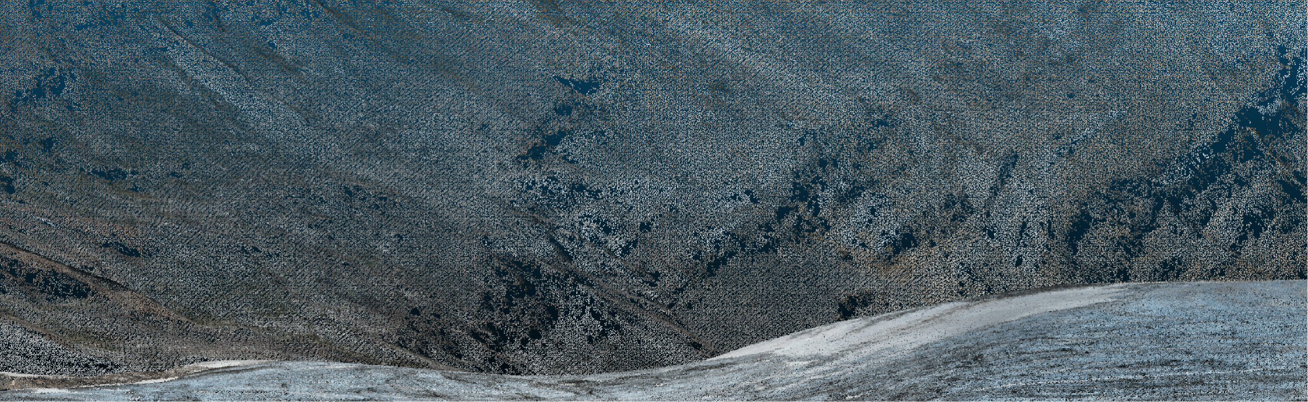
Elevating Topographic Surveys with LiDAR and Orthophotos
Harnessing the Power of LiDAR
LiDAR (Light Detection and Ranging) technology has revolutionized the field of topographic surveying. By emitting laser pulses from aerial platforms and measuring the reflected signals, LiDAR creates highly accurate, three-dimensional representations of the terrain.
In mining, LiDAR is invaluable for:
- Site Planning: Identifying optimal locations for infrastructure.
- Environmental Impact Assessments: Mapping sensitive areas to avoid.
- Safety Analysis: Detecting potential geohazards like landslides or erosion zones.
Our LiDAR services provide detailed Digital Elevation Models (DEMs) and Digital Surface Models (DSMs), which are essential for planning and operational efficiency.
The Role of Orthophotos
Orthophotos are aerial photographs geometrically corrected to have a uniform scale, eliminating distortions caused by camera tilt or terrain. When combined with LiDAR data, orthophotos offer a rich, detailed view of the mining site.
Applications include:
- Mapping and Visualization: High-resolution images for better understanding of site conditions.
- Change Detection: Monitoring alterations over time, crucial for compliance and reporting.
- Integration with GIS: Enhancing Geographic Information Systems with accurate imagery.
By providing orthophotos alongside LiDAR data, we deliver a comprehensive topographic solution that enhances every aspect of mining operations.
Supporting Mine Construction: Surveys for Infrastructure Development
Construction Layout and Staking
The construction phase of a mining project involves building critical infrastructure such as crushers, conveyors, and foundations. Precise surveying is essential to ensure that these structures are built accurately according to design specifications.
Our services include:
- Layout Surveys: Establishing the exact locations for structures.
- Staking: Marking reference points on the ground for construction crews.
- As-Built Surveys: Verifying that constructed elements match design plans.
By providing accurate and reliable data, we help streamline the construction process, reduce errors, and ensure that your mining infrastructure is built to last.
Navigating the Depths: Underground Mining Surveys
Scanning for Drifts
In underground mining, drifts are horizontal passages used for access or exploration. Accurate surveying of these drifts is essential for navigation, safety, and planning future excavations.
We utilize advanced underground scanning technologies, such as:
- Laser Scanning: Capturing detailed 3D models of drifts.
- Total Stations: Providing precise measurements in confined spaces.
- Gyroscopic Tools: Ensuring accuracy when GPS is unavailable underground.
These methods allow us to map underground environments accurately, aiding in everything from logistical planning to emergency response preparedness.
Deformation Monitoring
Underground structures are subject to stress and can deform over time, posing significant safety risks. Deformation monitoring involves measuring changes in the shape or position of underground passages and voids.
Our services include:
- Regular Monitoring Surveys: Tracking changes over time.
- Real-Time Sensors: Providing immediate alerts for critical movements.
- Data Analysis and Reporting: Offering actionable insights to mitigate risks.
By keeping a close eye on subterranean shifts, we help maintain the integrity of underground operations and ensure the safety of all personnel.
Seamless Integration with Industry-Leading Software
To enhance the efficiency and effectiveness of our services, we provide data that is fully compatible with industry-standard software platforms:
- MineSight 3D
- Vulcan
- Deswik
- QGIS
This compatibility ensures that you can seamlessly integrate our high-quality survey data into your existing workflows for mine planning, modeling, and spatial analysis. By facilitating easy data import and export, we help streamline your operations and accelerate decision-making processes.
Our Commitment to Excellence in BC, Alberta, and Yukon
Operating in the diverse terrains of British Columbia, Alberta, and the Yukon presents unique challenges and opportunities. Our team is not only equipped with cutting-edge technology but also possesses an in-depth understanding of the local geological and regulatory landscapes.
Why Choose Us?
- Expertise: Decades of experience in mining surveying services.
- Advanced Technology: Utilizing the latest in LiDAR, orthophotography, and underground scanning.
- Data Compatibility: Providing data ready for use in MineSight 3D, Vulcan, Deswik, and QGIS.
- Safety First: Adhering to the highest safety standards in all operations.
- Customized Solutions: Tailoring services to meet the specific needs of each project.
- Regulatory Compliance: Ensuring all surveys meet local and federal guidelines.
We are dedicated to providing comprehensive surveying solutions that drive efficiency, safety, and profitability in your mining operations.
Conclusion: Precision Matters
In the complex world of mining, precision is more than a luxury—it’s a necessity. From the initial planning stages to ongoing operations and closure, accurate surveying underpins every successful mining project. Whether it’s marking blasting points with exactness, delineating ore limits, calculating volumes, supporting infrastructure construction, or mapping intricate underground passages, our mining surveying services are designed to meet the highest standards.
By ensuring compatibility with industry-leading software like MineSight 3D, Vulcan, Deswik, and QGIS, we make it easier for you to integrate our data into your workflows, enhancing collaboration and efficiency. Operating across British Columbia, Alberta, and the Yukon, we bring local expertise and advanced technological capabilities to your projects.
Let us partner with you to navigate the challenges and unlock the full potential of your mining endeavors.
Ready to Elevate Your Mining Operations?
Contact us today to learn more about how our comprehensive mining surveying services can benefit your project.